Plastic Raised Map Production Systems

Comprehensive Plastic Raised Relief Map System

Our innovative plastic raised relief map production system is designed to provide you with complete technological independence. Beyond a simple product delivery, we offer a full-scale transfer of technology and expertise, enabling your organization to become a self-sufficient producer in the field of geoinformatics.


Rapid Operational Readiness

We don’t just provide the tools; we provide the mastery. Our comprehensive 2-month intensive training program is meticulously structured to ensure your team transitions from setup to full-scale, independent production with confidence.


Total Autonomy in Production

Our primary goal is to eliminate external dependency. By integrating our specialized hardware and software platforms into your own facilities, you gain the capability to manage the entire production cycle in-house.


Innovative Technology

At the core of our system lies a cutting-edge synergy of advanced software and high-precision hardware. This innovative platform allows you to transform complex geospatial data into high-quality physical relief maps, ensuring you stay at the forefront of modern cartographic technology.


MapForm Software

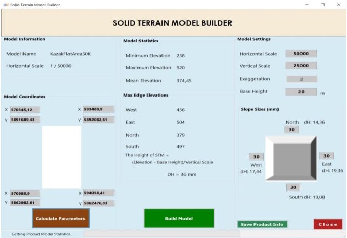
MapForm-PC software, which is one of the components of the Relief Map Production System, is the application for database management and 3D solid model design. It allows the digital terrain model, raster bases to load-update-delete operations into the geodatabase via the software, as well as the database’s backup, optimization, etc. studies can be carried out.